
Atlantic Disturbance Still Could Develop & 100 Years Ago This Morning a Monster Hurricane Was Two Days Out from Miami

SEPTEMBER 16, 1926
The weather map had the South Florida newspapers flummoxed. A 40-mph tropical storm had been drifting offshore of Miami. Its fringes produced gusty winds along the coast and about 2 inches of rain. Meanwhile, a monster hurricane was north of Puerto Rico and on a track aimed at South Florida. But nobody yet understood the threat.

Through the morning, the weather deteriorated on Turk Island, now called Grand Turk, at the southern end of the Bahamian chain. Through the afternoon and into the evening, the storm ripped and roared causing massive flooding and widespread devastation. The modern estimate is that the hurricane had reached Category 4 strength with 145 mph winds when it hit the Turks and Caicos Islands.
By that afternoon, the U.S. Weather Bureau in Washington had gotten word of the storm’s assault on Turk Island. They finally knew that the hurricane was extremely strong, but warnings for Florida weren’t issued until the following day.

The Fort Lauderdale Daily News that Thursday morning the 16th had a sub-headline about the tropical storm "moving toward coast." The concern was for houseboat dwellers in West Palm Beach – a seemingly niche issue. But this alert was related to the weakening tropical storm just offshore and nothing to do with the giant hurricane.
The headline on the front page of the morning Miami Herald said, "Storms to Miss Coast of Florida." They confidently reported that the "Three Hurricanes in Southeast Head in Other Directions." It's not clear what they meant by "southeast."
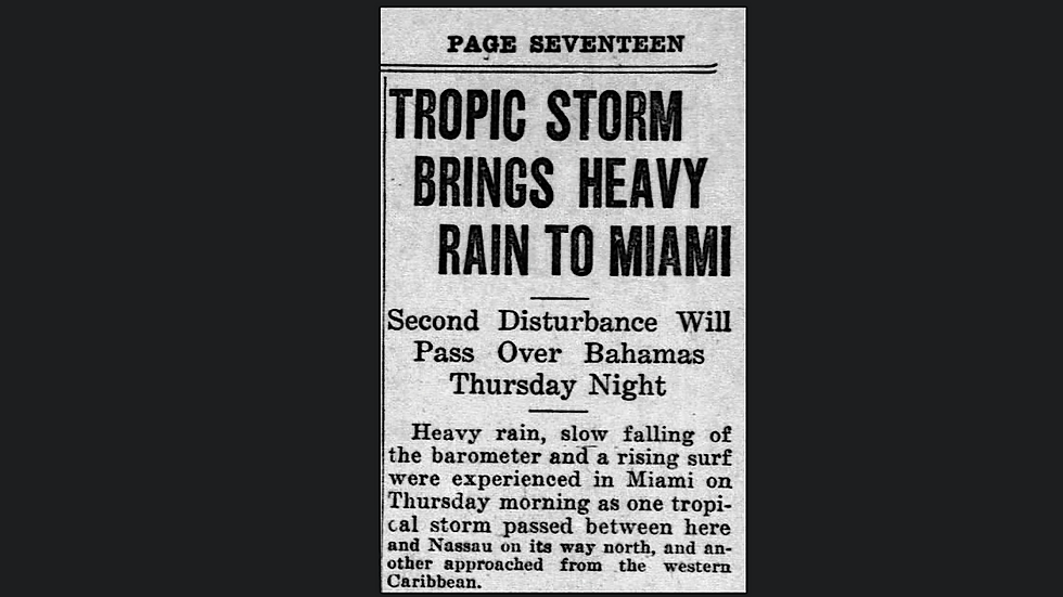
The Miami Daily News that afternoon made mention of the hurricane, but in a very offhand way on Page 17. The headline referred to the effects of the tropical storm offshore, but the last line mentioned "another (storm that) approached from the western Caribbean." That was it!
When people in greater Miami went to bed that night, they had no idea that that was their last night of peace. Miami – the so-called Magic City – had grown from nothing into a center of glitz and glam in 30 years. The city and surrounding South Florida in their current state had one day left.
IN THE ATLANTIC IN 2026
The year without much of a hurricane season continues.
The broad and disorganized non-tropical low-pressure system in the middle of the Atlantic still has a chance of developing into a tropical depression or tropical storm, but the odds are decreasing.

Some computer forecast models still show the system eventually spinning up into a strong storm, but they are in the minority. If it can pull itself together, however, it could become the first hurricane of the season as it heads into the North Atlantic. Although the consensus now is that little or no development will take place.
The National Hurricane Center has the odds in the low range that a tropical depression will form in the yellow hatched area. Folks in Bermuda should still keep an eye on it to be sure it doesn't do something unexpected.
IN THE PACIFIC
There are three potential development areas. The system that has a low chance of developing near Mexico will have to be watched. If it does come together, there is some possibility it could affect the coast before it moves out to sea. But nothing is imminent.

The system with a medium chance that looks like it could head toward Hawaii is more likely to turn north into the open Pacific if it develops.
And there's a small disturbance in the Gulf of California that has a slight chance of developing, although most of the system is already over land.
Comments