
Ex-Isaias Spreading a Flood Threat Far and Wide and Two Pacific Storms to Watch

Hurricane Isaias made landfall near Destin, Florida, yesterday evening with an estimated 105 mph winds. Storm surge pounded the northern Gulf Coast east to Panama City and beyond. The western eye wall was the most intense. It lingered over the Fort Walton Beach area. Wind gusts were measured approaching 120 mph across the western Florida Panhandle and into southern Alabama.
Now the remnants of Isaias's circulation are tracking north through Alabama. Winds are still gusty enough to take down tree limbs and knock out some power. The high wind alerts cover North Georgia and the higher elevations of the Southeast, as well. Use caution moving around today.
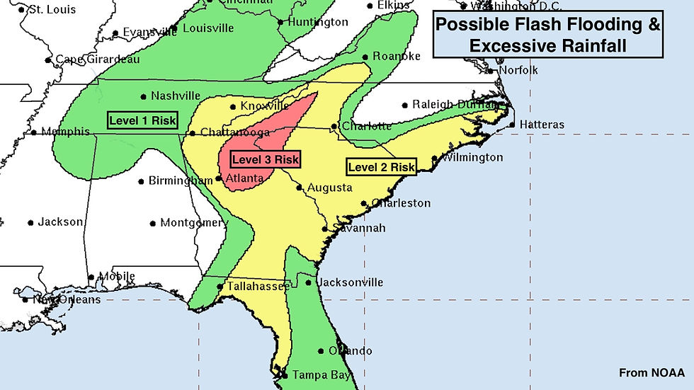
Ex-Isaias is combining with a large upper-level low-pressure system to spread rain across the south and into the Midwest. Flash flooding is possible, especially in North Georgia and into the Smoky Mountains. Flooding is also likely in the Lowcountry of the Carolinas, where the tides are running very high so draining of the rainwater will be slow.
Some tornadoes are still possible from the Florida Panhandle across southeast Georgia into the Carolinas.
Heed the alerts from the National Weather Service for your area. The dangerous weather warnings and advisories will be frequent and widespread.
Sorting out how Isaias's interaction with the jet stream was going to affect the storm track was a major challenge in forecasting the hurricane. The AI computer forecast models kept predicting a track on the right side of the cone – farther east. In the end, the Google DeepMind AI forecast was once again the best. The new machine learning models continue to amaze, especially for developed systems with an identifiable center.
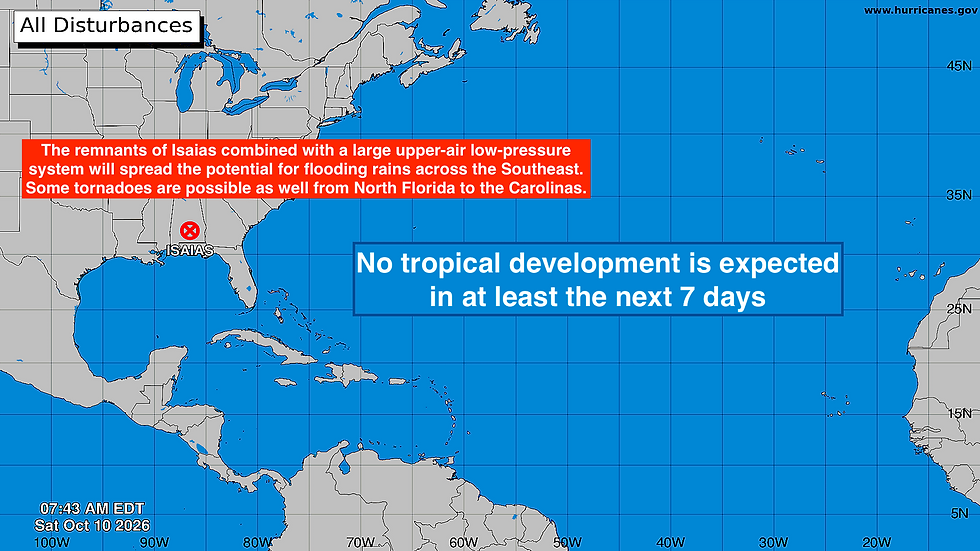
There is no indication of any tropical development across the Atlantic, the Caribbean, or the Gulf for the foreseeable future. We never can completely rule out a system like Isaias spinning up in the southern Gulf, but the El Niño-driven jet stream is fierce, which is making development unlikely.
IN THE PACIFIC
Tropical Storm Rachel is heading for northern Baja California. Gusty winds and periods of rain will spread across the southern part of the State of California as well as northern Mexico as it combines with a strong northern disturbance swinging into the Southwest. The biggest effect of the combo system will likely be in the Desert Southwest and into the Intermountain West where flooding rain is possible.
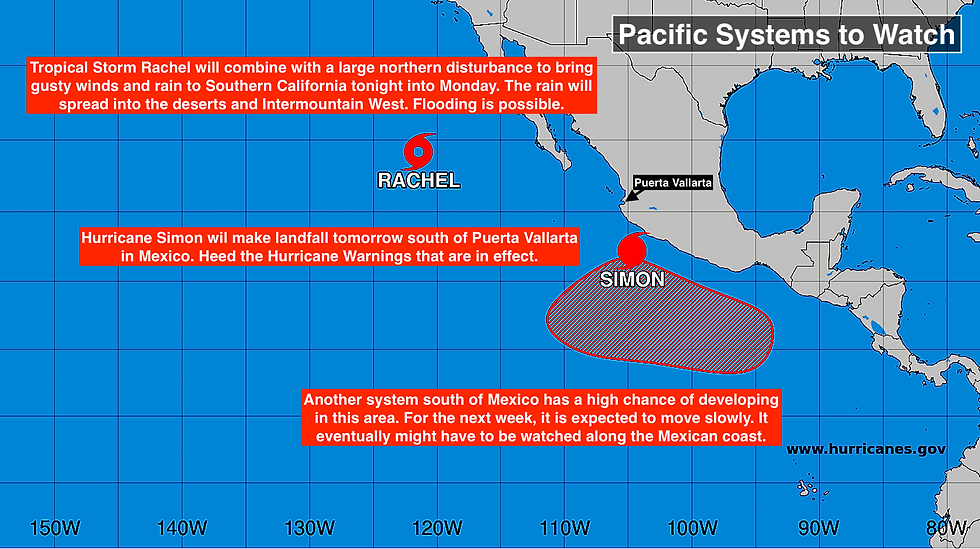
For San Diego, Los Angeles, and the surrounding areas, the rainy stretch to come means an end to the brutal heat wave of last week.
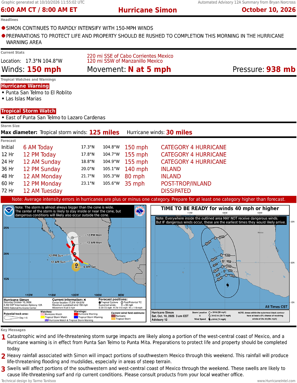
Farther south, Hurricane Simon is still strengthening and heading for the west-central Mexican coast tomorrow. But a somewhat weaker version of the storm will pass over or near Puerto Vallarta. Everybody there needs to pay attention to local instructions, prepare for the power to be out, and be sure they're in a safe place until the storm passes.
Another system is likely to form even farther south. This one looks likely to drift slowly off the coast of southern Mexico for a good while. Eventually, it might have to be watched and could be a threat to the coast. But that's a good way off, and the forecasts are uncertain.
Comments