
FINALLY… THE TROPICAL WATERS ARE CLEAR OF ANY SYSTEMS THAT MIGHT BE A THREAT
- Bryan Norcross

- Sep 23, 2020
- 2 min read
It almost certainly won’t last for the rest of the hurricane season, but after a month and a half of nonstop tropical activity, the depression, tropical storm, and hurricane development system has been turned off.
There are still two systems of note, but neither are any longer tropical systems.
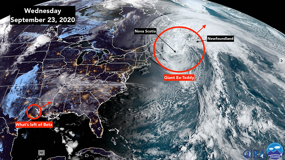
Ex-Beta has just passed the Houston area in Texas. With the center of circulation over land, wind is no longer a significant issue. But the rain continues to fall, and it’s spreading into the Southeast. The flood threat will continue for the next few days.

In the North Atlantic, former-hurricane Teddy has morphed into a giant winter-type storm. It’s over 800 miles across – getting near the off-the-charts size of Hurricane Sandy when it was approaching New York and New Jersey 8 years ago. The massive storm will slam into the far-eastern Canadian provinces of Nova Scotia and Newfoundland today and into tomorrow.
The huge circulation is moving a lot of water in the ocean – energizing powerful swells that are causing dangerous surf and pushing tides higher along the U.S. East Coast. Even in South Florida, rip currents are being enhanced by the swells from ex-Teddy.
In the far eastern Atlantic, the zombie storm Paulette is dead again. It arose for a brief afterlife when it tracked over warm enough water to regain its tropical storm status. But now that’s over as it once again is reduced to a minor swirl. Such is the circle of life.
The potential disturbance from the cold front that settled near Cuba is now considered a remote possibility – too remote to focus on. A minor low-pressure area may develop, but conditions do not appear favorable for development.
All indications are that the tropics will stay calm into next week, at least.
Comments