Hurricane season begins with a quiet Atlantic
- Bryan Norcross

- Jun 1, 2021
- 3 min read
Welcome to Hurricane Season 2021! Fortunately, Mother Nature is playing a different hand this year compared to last.
On June 1, 2020, the third tropical depression of the season had already developed. It turned into Tropical Storm Cristobal the following morning.
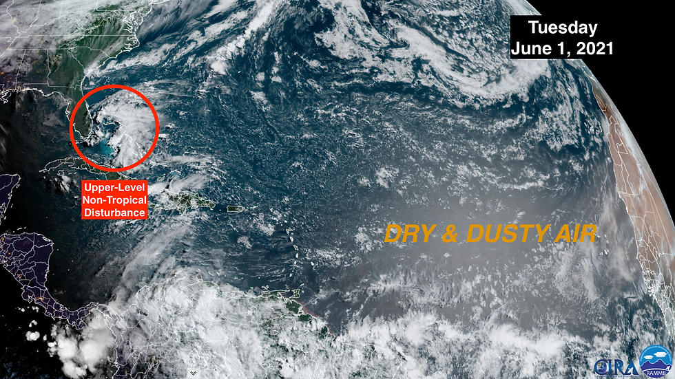
This year, strong upper-level winds are blowing across the Gulf, Caribbean, and tropical Atlantic Ocean. As long as that flow keep up, any tropical disturbances that think about developing will get blasted and fall apart.

In the middle of the atmosphere, dust from Africa is already covering the eastern tropical Atlantic. That will tend to dry out any systems that want to get going.

A typical summertime wind flow across the ocean has already set up, however. It’s pushing increasingly moist air over the Florida peninsula. That moisture, strong June sun, an upper-level disturbance over the Bahamas, and we have the ingredients for some extra-heavy thunderstorms.
The upper disturbance is an extension of a northern weather system. The seasonal mixing of northern systems containing cool air with moist tropical air blowing off the ocean is what makes June the rainiest month on average in South Florida. Contrasting air masses make strong storms and heavier rain.
The other extra-rainy month on average is September. That’s when tropical systems are most likely to track over or near Florida.
Based on what we know now, the 2021 Hurricane Season will be significantly less busy than last year – at or slightly above the average level of activity we’ve experiences in recent years.
The official records show an average of 14 named storms in the Atlantic, Gulf, and Caribbean. But those averages are calculated over the 30 years from 1991 to 2020. Technology in the 90s was far inferior to what we have today, so at least 1 or 2 more storms are detected each season these days than would have been named at that time. That means, if we think of 15 or 16 as normal, this year’s forecast of 17 or so is just barely above average.
In the plus column for more storms, it is forecast to be a stormy year over Sub-Saharan Africa. Disturbances that form there become the seeds for tropical depressions and storms over the Atlantic. If you throw out more seeds, in general, more things grow.
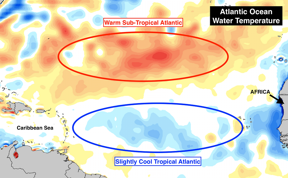
The tropical Atlantic, on the other hand, is not especially warm. It’s a bit on the cool side of average. A little to the north, the sub-tropical Atlantic, on the other hand, is quite warm. So they, in some sense, cancel each other out when we think about the ocean’s effect on developing tropical systems - if the current temperature regime continues through the season, which it often doesn't.

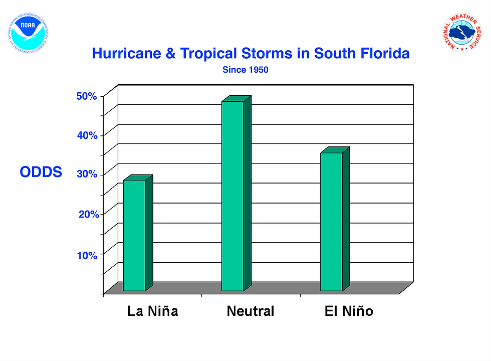
In the Pacific, there is neither an El Niño or a La Niña. Neutral years are sometimes extra busy and sometimes not, so there’s nothing to know from there.
The National Weather Service in Miami found an annoying related stat, however. Since 1950, tropical storms and hurricanes have been more likely to bother South Florida in one of these neutral years than under an El Niño years or a La Niña. So, just based on this factor, there’s just under a 50-50 chance of a storm threat this year.

This is all interesting, of course, but the bottom line is still the same. It’s early. Things can change. And it only takes one bad hurricane to change everything, which can happen under any overall weather and ocean regime.
There is nothing to do but be prepared. If you want save some money, shop now. Hurricane supplies are currently tax-free in Florida.

Comments