
Louisiana Flood Threat Continues as the Tropics Remain Dry
- Bryan Norcross

- Jul 18, 2025
- 1 min read
What’s left of the tropical disturbance we were following—recall it was officially tagged Invest #93L—is creeping across the southern part of Louisiana. The flood threat continues for the southern parishes of Louisiana and southern Mississippi as well.
Up to a foot of rain has already fallen east and southeast of Lafayette, Louisiana, and a few more inches will likely fall today from slow-moving tropical downpours that are still rotating around the dying disturbance.
Stay in touch with the latest information from the local National Weather Service offices, and be aware that some flash flooding is still possible.
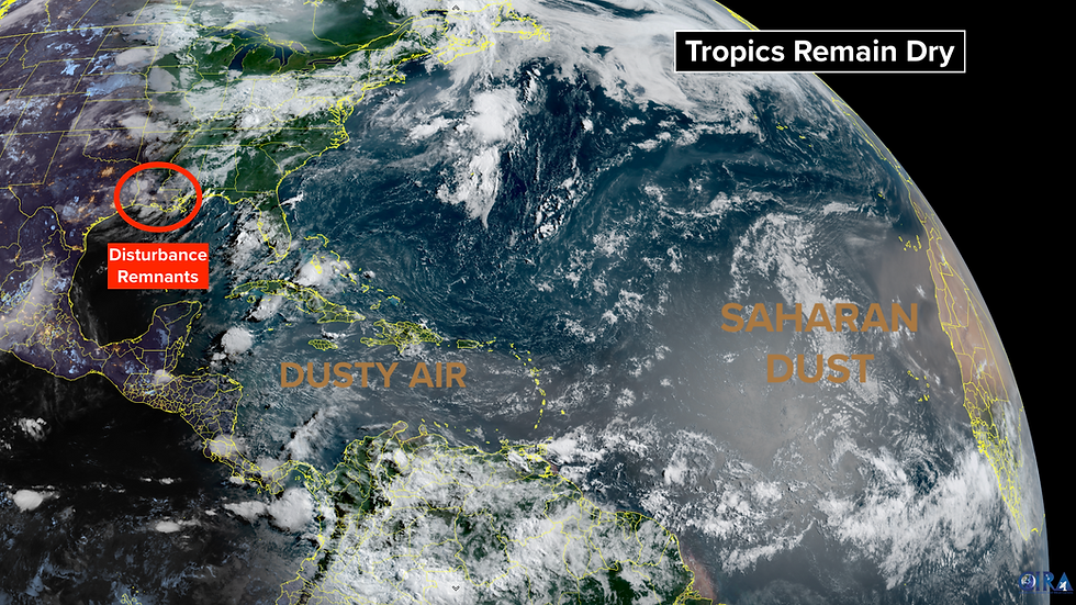
The tropical Atlantic and the Caribbean remain exceptionally dry. Saharan dust covers much of the tropical belt, and high pressure dominates, which has a drying effect as well.
Tropical disturbances are moving off Africa, and the ocean waters between the Caribbean and Africa are warming. The air is so dry, however, that systems can't get going. This pattern is not uncommon in mid-July, and is expected to continue through next week, at least.

The large-scale atmospheric pattern looks to become more conducive for tropical development in early August, but we'll see. In the meantime, another system like this week's disturbance could develop in the northern Gulf or off the Southeast coast, but nothing is expected in the deep tropics.
Comments