
No Apparent Tropical Trouble at the Moment While We Look Back at the Peak of the Incredible Season 100 Years Ago

100 YEARS AGO TODAY
The modern record book shows that the tropical storm east of the Caribbean became a 75-mph hurricane on the morning of September 12, 1926. It was heading in the general direction of the waters just north of Puerto Rico.
On that same morning, a tropical depression with 35 mph winds was creeping north in the Caribbean south of western Cuba.
That Sunday, the newspapers in Miami and Fort Lauderdale had no coverage of these two systems, which would eventually converge on South Florida. The front page of the Miami Herald did report on the powerful hurricane that was crawling in the general direction of the northeastern seaboard of the U.S. The Category 4 storm was sending strong swells towards the coast south of Charleston, South Carolina.
Unbeknownst to anybody on that summer Sunday, this would be the last carefree weekend for the residents of Greater Miami for some time to come.
IN THE ATLANTIC IN 2026
The hostile environment persists, and there is no sign of tropical development for the foreseeable future.

IN THE PACIFIC
Norbert is still a tropical storm heading in the general direction of Hawaii. The environment ahead looks even less supportive than it did yesterday, so the National Hurricane Center forecast does not call for significant strengthening.
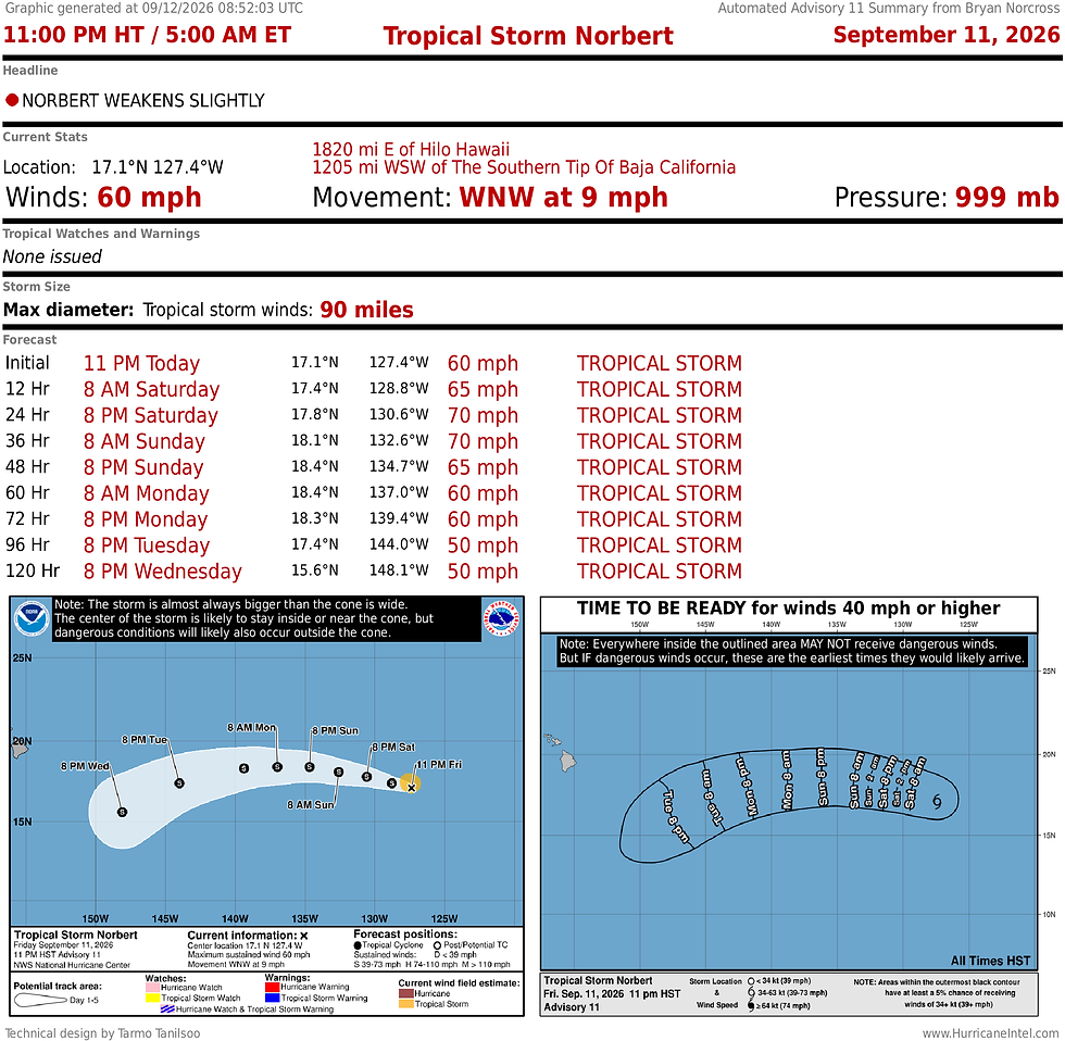
We'll keep an eye on the storm in about a week to be sure it's not going to regenerate and affect the islands. But as of today, the consensus of the long-range computer forecasts is that it won't be an issue.

Right on its heels, another system is likely to develop. This one will eventually be named Odalys. Again, it looks to head in the general direction of Hawaii, but long-range computer forecasts don't indicate any threat to land.
Comments