
No sign of development but watching the Bahamas disturbance
- Bryan Norcross

- Oct 4, 2021
- 1 min read
The area of disturbed weather roughly centered east of the central Bahamas is mostly just a huge blob of disorganized tropical moisture. Meteorologically, it’s an elongated area of low-pressure at the surface being enhanced by a sharp dip in the jet stream that extends all the way into the Caribbean. The dip is pulling tropical moisture north and is enhancing the elongated disturbance.

As the disturbance lifts slowly north through this week, the upper-level winds are forecast to be pretty hostile to development until late in the week when it’s near or off the coast of Georgia or the Carolinas. Even then, the atmospheric pattern is only predicted to be marginal for tropical development.
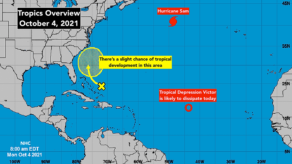
Nothing is likely to happen quickly, and most of the bad weather with the disturbance should be over the ocean east of the Bahamas this week.
Hurricane Sam is hanging on as a Category 2 hurricane but weakening is forecast as it charges into the North Atlantic. In the next day or so, it will slowly merge with an upper-level low-pressure system and turn into a giant wintertime-like system in the waters south of Greenland.

In the eastern Atlantic, Victor is about to give up. Dry air and strong upper-level winds are winning the day, stripping its thunderstorms away and disrupting its circulation. It should be history later today or tonight.
Elsewhere, the atmospheric pattern looks fairly hostile to tropical development and nothing is expected through late week, at least.
Comments