
Storm that produced hurricane gusts in New England still has a chance to become Wanda
- Bryan Norcross

- Oct 27, 2021
- 1 min read
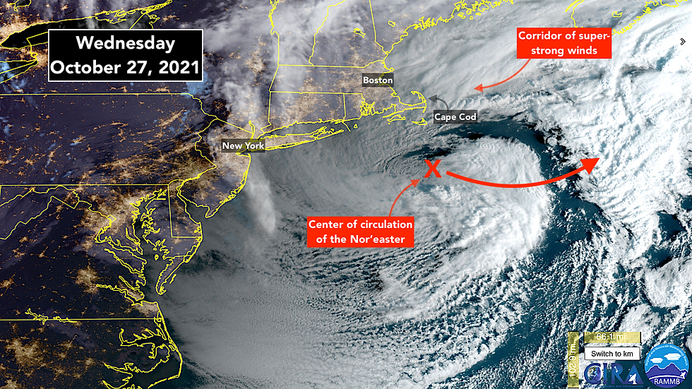
An intense nor’easter – a northern coastal storm with most of its impactful winds coming from the northeast – will slowly pull away from the New England coast today. Winds gusted over 90 mph on Cape Cod overnight and are still high across southeastern Massachusetts, Rhode Island, and Long Island, New York.
Trees are down and power is out in a large part of that area. Travel there is not recommended today.
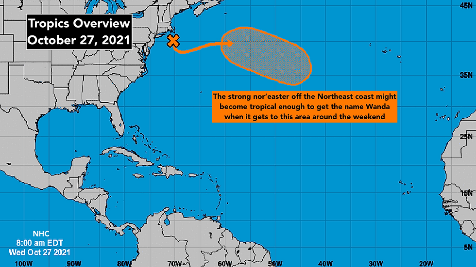
Late in the week or over the weekend, the storm will be over warmer Gulf Stream waters. If the National Hurricane Center determines that the system is sufficiently energizing itself using heat from the ocean, they will name it Wanda.
There has not been a named storm on the board since Sam’s last advisory on October 5th. According to Dr. Phil Klotzbach, the guru of hurricane stats, only twice since 1995 have we had an October pause like this. That was in 2006 and 2007.
And going back to beginning of the satellite era in 1966, when accurate records for the Atlantic began, only four seasons ended earlier than October 5th: 1982, 1983, 1993, and 2006.
But if hurricane season really is over, it doesn’t fit the pattern of the past. This year, some of the major factors continue to be conducive for development. And those previous early-ending years were slow hurricane seasons overall. While, of course, 2021 was rip-roaring out of the gate.
Regardless of the reason or reasons, the long-range computer forecast models show a very low chance of anything except for potential-Wanda developing well into November. After this week, the season is probably over.
Comments