SUPER-FIERCE HURRICANE IOTA SET TO RAM NICARAGUA AND HONDURAS TONIGHT
- Bryan Norcross

- Nov 16, 2020
- 2 min read
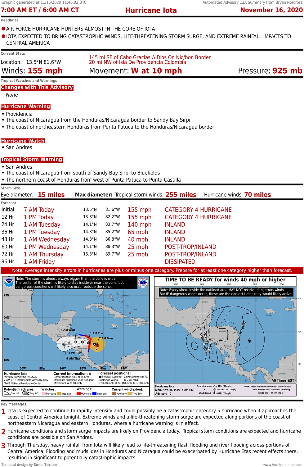
Hurricane Iota is on the cusp Category 5 strength as it is on final approach to landfall on the coast of Nicaragua near the Honduras border this evening.
A Category 5 storm has not formed in the Atlantic, the Caribbean, or the Gulf of Mexico in November in modern times, although the infamous Cuba Hurricane of 1932 is estimated to have peaked at 175 mph – Category 5 strength – in a similar place in the Caribbean where Hurricane Iota is today. That was November 6, 1932 as the storm was heading for the Cayman Islands and the southern coast of Cuba.
When Hurricane Iota makes landfall late today, the National Hurricane Center is predicting that the water along the coast will be pushed 12 to 18 feet above the normal tide level devastating coastal areas to the right of where the center comes ashore along the Nicaraguan and Honduran coasts. Meanwhile, winds gusting over 150 mph will rip at anything still standing.

As Iota goes inland, once again rainfall totals up to 20 to 30 inches will cause massive flooding and mudslides in the mountainous terrain of Central America.
A lot of strange things have happened this hurricane season, including the interminable duration of it. But perhaps the eeriest earlier this year was Hurricanes Laura and Delta – a Category 4 and a Category 2 – hitting the same place in Louisiana 6 weeks apart. Laura caused $14-billion in damage and Delta $4-billion.
Now it’s happening again – this time in Nicaragua. Except Hurricanes Eta and now Iota are hitting the same area 2 weeks apart. Eta was a Category 4 at landfall, and Iota is forecast to come in near or at Category 5 strength. It’s a bizarre and tragic coincidence.
Imagine reeling from a Category 4 hurricane to get the news that another stronger storm was coming 2 weeks later.

In another bizarre 2020 twist, yet another system might form in exactly the same area later this week. In the National Hurricane Center graphic, you can see the yellow area just below the hurricane symbol representing Iota.

If another tropical system forms, it too would likely track to the west toward Central America, south of the zone devastated by Eta and Iota. High pressure over Florida and the Gulf will keep systems to the south and generally moving east to west.
Only in the extreme southern Caribbean Sea is the atmospheric environment still conducive to tropical development. For now, hurricane season is at least on pause and probably over for the rest of the Caribbean and points north including Florida.

Comments