
The last vestiges of hurricane season are still spinning in the Gulf and near the Bahamas
- Bryan Norcross

- Nov 10, 2024
- 2 min read
This should be the last day with systems in the Gulf or near Florida this hurricane season. A disturbance could still develop in the extreme southern Caribbean this year, but a parade of fronts looks likely to push any future tropical weather well south of the U.S.

Tropical Storm Rafael is on its last legs. Dry air and hostile upper winds are ripping the storm apart. The thunderstorms with the system are far displaced from the low-level circulation, which is the center we track.
The National Hurricane Center's forecast shows Rafael becoming a remnant low-pressure system by tomorrow and dying out over the Gulf waters in the next few days.
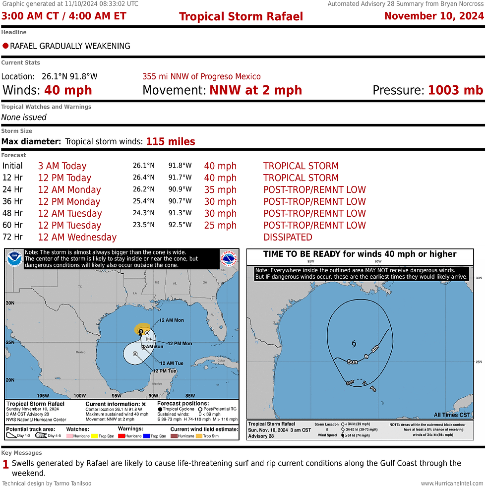
The system can still cause dangerous conditions at the beaches along the northern and western Gulf coast. But otherwise, it won't affect land.
NEAR THE BAHAMAS, the disturbance we have been watching north of the Caribbean islands is approaching The Bahamas. It's very unlikely to develop but will still bring a gusty wind surge and some tropical downpours to the central and northwestern Bahamian islands today.

The effects in South Florida are expected to be minimal – just a little better chance of showers blowing off the ocean tonight into tomorrow. Hostile upper winds should wipe out the system by tomorrow night.
The first in a series of cold fronts is forecast to push down the Florida Peninsula midweek as the fall weather regime settles in.
The American GFS computer forecast model once again shows a storm spinning up in the southern Caribbean next week – you might see provocateurs posting click-bait maps on social media. That model has a history of bogus attention-getting, however, and should be ignored until and unless there is support from other computer forecasting schemes.
Comments